GEOS-Chem horizontal grids: Difference between revisions
| (43 intermediate revisions by one other user not shown) | |||
| Line 5: | Line 5: | ||
If you are running GEOS-Chem in "Classic" mode (i.e. without the ESMF library and MPI parallelization), then you may use any of the Cartesian ("lat-lon") grids that are listed below for your simulations. | If you are running GEOS-Chem in "Classic" mode (i.e. without the ESMF library and MPI parallelization), then you may use any of the Cartesian ("lat-lon") grids that are listed below for your simulations. | ||
GEOS-Chem stores horizontal grid information in the source code module <code>GeosUtil/gc_grid_mod.F90</code> (formerly known as <code>GeosUtil/grid_mod.F90</code>. You may call several of the routines of <code>gc_grid_mod.F90</code> to return the horizontal coordinates of a grid box given the grid box indices. | ''NOTE: This applies to GEOS-Chem versions prior to 12.4.0:'' GEOS-Chem stores horizontal grid information in the source code module <code>GeosUtil/gc_grid_mod.F90</code> (formerly known as <code>GeosUtil/grid_mod.F90</code>. You may call several of the routines of <code>gc_grid_mod.F90</code> to return the horizontal coordinates of a grid box given the grid box indices. | ||
Our HPC-enabled version of GEOS-Chem (aka GCHP) can read input data on cubed-sphere grids. For more information, please see [[GEOS-Chem HP|our ''GEOS-Chem HP'' wiki page]]. | Our HPC-enabled version of GEOS-Chem (aka GCHP) can read input data on cubed-sphere grids. For more information, please see [[GEOS-Chem HP|our ''GEOS-Chem HP'' wiki page]]. | ||
| Line 11: | Line 11: | ||
--[[User:Bmy|Bob Yantosca]] ([[User talk:Bmy|talk]]) 21:35, 29 November 2016 (UTC) | --[[User:Bmy|Bob Yantosca]] ([[User talk:Bmy|talk]]) 21:35, 29 November 2016 (UTC) | ||
== GMAO 4 x 5 grid == | === FlexGrid: a new way to specify GEOS-Chem traditional and custom grids === | ||
The FlexGrid feature will be implemented into [[GEOS-Chem 12#12.4.0|GEOS-Chem 12.4.0]] and later versions. FlexGrid allows you to specify the traditional GEOS-Chem grid definitions (listed below), as well as custom grids, at runtime. It will no longer be necessary to recompile GEOS-Chem if you want to switch from one grid to another. | |||
For more information about FlexGrid, please see [[FlexGrid|our ''FlexGrid'' wiki page]]. | |||
--[[User:Bmy|Bob Yantosca]] ([[User talk:Bmy|talk]]) 15:05, 30 May 2019 (UTC) | |||
== Traditional GEOS-Chem grid definitions == | |||
The "traditional" GEOS-Chem global and nested grid definitions are listed below. | |||
=== GMAO 4 x 5 grid === | |||
[[FlexGrid#4.C2.B0_x_5.C2.B0_global_grid|This grid may be specified via FlexGrid with these settings in <tt>input.geos</tt>]] (in GEOS-Chem 12.4.0 and later). | |||
[[File:grid_gmao4x5.png]] | [[File:grid_gmao4x5.png]] | ||
| Line 36: | Line 50: | ||
70.000 74.000 78.000 82.000 86.000 89.000 | 70.000 74.000 78.000 82.000 86.000 89.000 | ||
== GMAO 2 x 2.5 grid == | === GMAO 2 x 2.5 grid === | ||
[[FlexGrid#2.C2.B0_x_2.5.C2.B0_global_grid|This grid may be specified via FlexGrid with these settings]] (for GEOS-Chem 12.4.0 and later). | |||
[[File:grid_gmao2x25.png]] | [[File:grid_gmao2x25.png]] | ||
| Line 76: | Line 92: | ||
86.000 88.000 89.500 | 86.000 88.000 89.500 | ||
= | === GMAO 0.5 x 0.625 grid === | ||
This is the native resolution of the [[MERRA-2]] reanalysis product from GMAO. | This is the native resolution of the [[MERRA-2]] reanalysis product from GMAO. | ||
| Line 472: | Line 101: | ||
Lat_Center(J) = -90° + ( 0.5° * ( J - 1 ) ), J = 1, 361 | Lat_Center(J) = -90° + ( 0.5° * ( J - 1 ) ), J = 1, 361 | ||
=== 0.5 x 0.625 AS nested grid === | ==== 0.5 x 0.625 AS nested grid ==== | ||
This is the [[MERRA-2]] native resolution nested grid over China and SE Asia. | This is the [[MERRA-2]] native resolution nested grid over China and SE Asia. | ||
[[FlexGrid#0.5.C2.B0_x_0.625.C2.B0_nested_Asia|This grid may be specified with the following settings in <tt>input.geos</tt>]] (in GEOS-Chem 12.4.0 and later). | |||
[[File:MERRA2_05x0625_AS.png]] | [[File:MERRA2_05x0625_AS.png]] | ||
| Line 520: | Line 151: | ||
53.000 53.500 54.000 54.500 55.000 | 53.000 53.500 54.000 54.500 55.000 | ||
=== 0.5 x 0.625 EU nested grid === | ==== 0.5 x 0.625 EU nested grid ==== | ||
This is the [[MERRA-2]] native resolution nested grid over Europe. | This is the [[MERRA-2]] native resolution nested grid over Europe. | ||
[[FlexGrid#0.5.C2.B0_x_0.625.C2.B0_nested_Europe|This grid may be specified via FlexGrid with these settings in <tt>input.geos</tt>]] (in GEOS-Chem 12.4.0 and later). | |||
[[File:MERRA2_05x0625_EU.png]] | [[File:MERRA2_05x0625_EU.png]] | ||
| Line 560: | Line 193: | ||
70.000 | 70.000 | ||
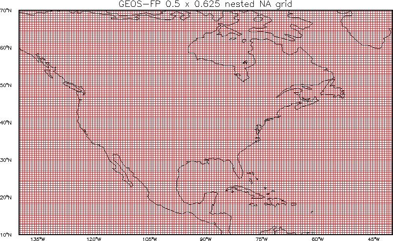
=== 0.5 x 0.625 NA nested grid === | ==== 0.5 x 0.625 NA nested grid ==== | ||
This is the [[MERRA-2]] native resolution nested grid over North America. | This is the [[MERRA-2]] native resolution nested grid over North America. | ||
[[FlexGrid#0.5.C2.B0_x_0.625.C2.B0_nested_North_America|This grid may be specified via FlexGrid with these settings in <tt>input.geos</tt>]] (in GEOS-Chem 12.4.0 and later). | |||
[[File:MERRA2_05x0625_NA.png]] | [[File:MERRA2_05x0625_NA.png]] | ||
| Line 609: | Line 244: | ||
70.000 | 70.000 | ||
== GMAO 0.25 x 0.3125 grid == | === GMAO 0.25 x 0.3125 grid === | ||
This is the native resolution of the [[GEOS-FP|GEOS-5 "forward processing" (which we call GEOS-FP)]] operational data product from GMAO. | This is the native resolution of the [[GEOS-FP|GEOS-5 "forward processing" (which we call GEOS-FP)]] operational data product from GMAO. | ||
| Line 618: | Line 253: | ||
Lat_Center(I) = -90° + [ 0.25° * ( J - 1 ) ], J = 1, 721 | Lat_Center(I) = -90° + [ 0.25° * ( J - 1 ) ], J = 1, 721 | ||
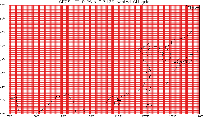
=== 0.25 x 0.3125 CH nested grid === | ==== 0.25 x 0.3125 CH nested grid ==== | ||
[[File:GEOSFP_025x03125_CH.png]] | [[File:GEOSFP_025x03125_CH.png]] | ||
This is the [[GEOS-FP]] native-resolution nested-grid over China. | This is the [[GEOS-FP]] native-resolution nested-grid over China. | ||
[[FlexGrid#0.25.C2.B0_x_0.3125.C2.B0_nested_China|This grid may be specified via FlexGrid with these settings in <tt>input.geos</tt>]] (in GEOS-Chem 12.4.0 and later). | |||
0.25° x 0.3125° CH longitude centers: | 0.25° x 0.3125° CH longitude centers: | ||
| Line 680: | Line 317: | ||
55.0000 | 55.0000 | ||
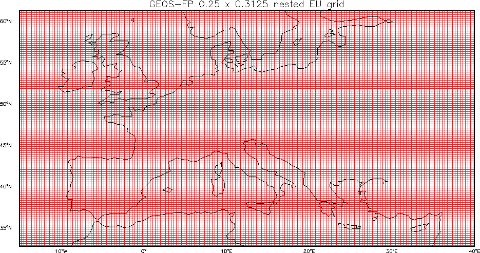
=== 0.25 x 0.3125 EU nested grid === | ==== 0.25 x 0.3125 EU nested grid ==== | ||
This is the [[GEOS-FP]] native-resolution nested-grid over Europe. | This is the [[GEOS-FP]] native-resolution nested-grid over Europe. | ||
[[FlexGrid#0.25.C2.B0_x_0.3125.C2.B0_nested_Europe|This grid may be specified via FlexGrid with these settings in <tt>input.geos</tt>]] (in GEOS-Chem 12.4.0 and later). | |||
[[File:GEOSFP_025x03125_EU.png]] | [[File:GEOSFP_025x03125_EU.png]] | ||
| Line 730: | Line 369: | ||
60.7500 61.0000 61.2500 | 60.7500 61.0000 61.2500 | ||
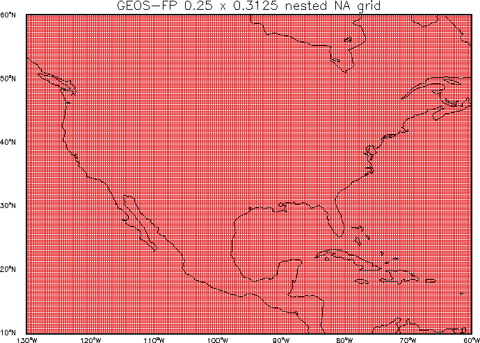
=== 0.25 x 0.3125 NA nested grid === | ==== 0.25 x 0.3125 NA nested grid ==== | ||
This is the [[GEOS-FP]] native-resolution nested-grid over North America | This is the [[GEOS-FP]] native-resolution nested-grid over North America | ||
[[FlexGrid#0.25.C2.B0_x_0.3125.C2.B0_nested_North_America|This grid may be specified via FlexGrid with these settings in <tt>input.geos</tt>]] (in GEOS-Chem 12.4.0 and later). | |||
[[File:GEOSFP_025x03125_NA.png]] | [[File:GEOSFP_025x03125_NA.png]] | ||
| Line 797: | Line 438: | ||
59.7500 60.0000 | 59.7500 60.0000 | ||
== | == Cubed-sphere grids used by GCHP == | ||
[[GEOS-Chem HP|GEOS-Chem with the high-perfomance option (aka GCHP)]] uses cubed-sphere horizontal grids instead of the traditional cartesian grids. For a good general description of cubed sphere grids, [https://geos-chem.seas.harvard.edu/cubedsphere please follow this link]. | |||
Cubed-sphere grid resolutions are denoted using the number of grid points on each face. The table below shows some common cubed-sphere configurations used by GCHP. At present GCHP uses grids with 72 vertical layers, but this may increase to 132 layers in the near future. | |||
{| border=1 cellspacing=0 cellpadding=5 | |||
|-bgcolor="#CCCCCC" valign="top" | |||
!width="75px"|Grid | |||
!width="75px"|# points<br>per face | |||
!width="100px"|# of cells<br>at surface | |||
!width="75px"|# of layers | |||
!width="100px"|# of cells<br> (total) | |||
!width="100px"|Equiv. lat-lon grid | |||
= | |-valign="top" | ||
|C24 ||24 ||3456 ||72 ||248,832 ||4° x 5° | |||
|-valign="top" | |||
|C48 ||48 ||13,824 ||72 ||995,328 ||2° x 2.5° | |||
|-valign="top" | |||
|C90 ||90 ||48,600 ||72 ||3,499,200 ||1° x 1.25° | |||
|-valign="top" | |||
|C180 ||180 ||194,400 ||72 ||13,996,800 ||0.5° x 0.625° | |||
|-valign="top" | |||
|C360 ||360 ||777,600 ||72 ||55,987,200 ||0.25° x 0.3125° | |||
|} | |||
'''Reference:''' Eastham, S.D., M.S. Long, C.A. Keller, E. Lundgren, R.M. Yantosca, J. Zhuang, C. Li, C.J. Lee, M. Yannetti, B.M. Auer, T.L. Clune, J. Kouatchou, W.M. Putman, M.A. Thompson, A.L. Trayanov, A.M. Molod, R.V. Martin, and D.J. Jacob, ''GEOS-Chem High Performance (GCHP): A next-generation implementation of the GEOS-Chem chemical transport model for massively parallel applications'', <u>Geosci. Mod. Dev.</u>, '''11''', 2941-2953, 2018. [https://www.geosci-model-dev.net/11/2941/2018/gmd-11-2941-2018.pdf PDF] | |||
Latest revision as of 11:35, 28 June 2023
On this page we provide information about the horizontal grids used by GEOS-Chem "Classic" simulations. For information about the vertical coordinates used by GEOS-Chem, please see our GEOS-Chem vertical grids wiki page.
Overview
If you are running GEOS-Chem in "Classic" mode (i.e. without the ESMF library and MPI parallelization), then you may use any of the Cartesian ("lat-lon") grids that are listed below for your simulations.
NOTE: This applies to GEOS-Chem versions prior to 12.4.0: GEOS-Chem stores horizontal grid information in the source code module GeosUtil/gc_grid_mod.F90 (formerly known as GeosUtil/grid_mod.F90. You may call several of the routines of gc_grid_mod.F90 to return the horizontal coordinates of a grid box given the grid box indices.
Our HPC-enabled version of GEOS-Chem (aka GCHP) can read input data on cubed-sphere grids. For more information, please see our GEOS-Chem HP wiki page.
--Bob Yantosca (talk) 21:35, 29 November 2016 (UTC)
FlexGrid: a new way to specify GEOS-Chem traditional and custom grids
The FlexGrid feature will be implemented into GEOS-Chem 12.4.0 and later versions. FlexGrid allows you to specify the traditional GEOS-Chem grid definitions (listed below), as well as custom grids, at runtime. It will no longer be necessary to recompile GEOS-Chem if you want to switch from one grid to another.
For more information about FlexGrid, please see our FlexGrid wiki page.
--Bob Yantosca (talk) 15:05, 30 May 2019 (UTC)
Traditional GEOS-Chem grid definitions
The "traditional" GEOS-Chem global and nested grid definitions are listed below.
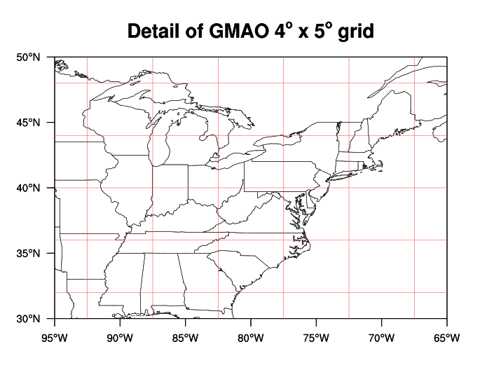
GMAO 4 x 5 grid
This grid may be specified via FlexGrid with these settings in input.geos (in GEOS-Chem 12.4.0 and later).
GMAO 4° x 5° longitude centers:
-180.000 -175.000 -170.000 -165.000 -160.000 -155.000 -150.000 -145.000
-140.000 -135.000 -130.000 -125.000 -120.000 -115.000 -110.000 -105.000
-100.000  -95.000  -90.000  -85.000  -80.000  -75.000  -70.000  -65.000
 -60.000  -55.000  -50.000  -45.000  -40.000  -35.000  -30.000  -25.000
 -20.000  -15.000  -10.000   -5.000    0.000    5.000   10.000   15.000
  20.000   25.000   30.000   35.000   40.000   45.000   50.000   55.000
  60.000   65.000   70.000   75.000   80.000   85.000   90.000   95.000
 100.000  105.000  110.000  115.000  120.000  125.000  130.000  135.000
 140.000  145.000  150.000  155.000  160.000  165.000  170.000  175.000
GMAO 4° x 5° latitude centers:
 -89.000  -86.000  -82.000  -78.000  -74.000  -70.000  -66.000  -62.000
 -58.000  -54.000  -50.000  -46.000  -42.000  -38.000  -34.000  -30.000
 -26.000  -22.000  -18.000  -14.000  -10.000   -6.000   -2.000    2.000
   6.000   10.000   14.000   18.000   22.000   26.000   30.000   34.000
  38.000   42.000   46.000   50.000   54.000   58.000   62.000   66.000
  70.000   74.000   78.000   82.000   86.000   89.000
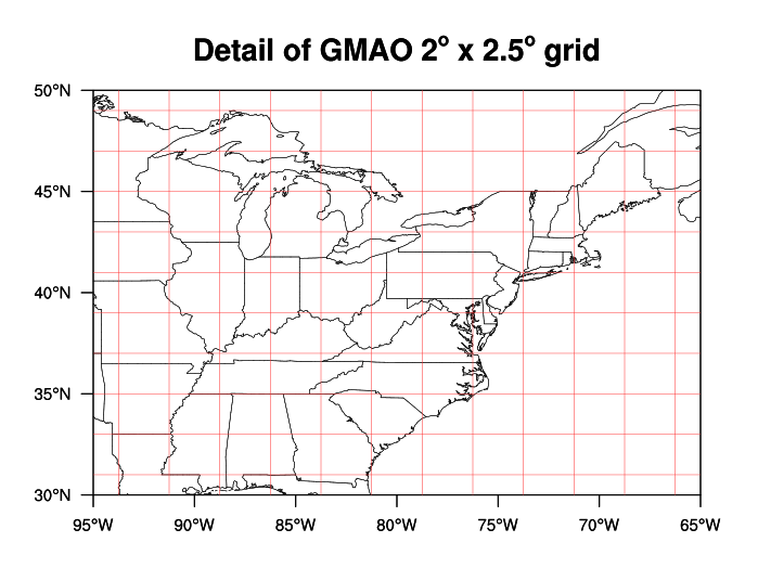
GMAO 2 x 2.5 grid
This grid may be specified via FlexGrid with these settings (for GEOS-Chem 12.4.0 and later).
GMAO 2° x 2.5° longitude centers:
-180.000 -177.500 -175.000 -172.500 -170.000 -167.500 -165.000 -162.500
-160.000 -157.500 -155.000 -152.500 -150.000 -147.500 -145.000 -142.500
-140.000 -137.500 -135.000 -132.500 -130.000 -127.500 -125.000 -122.500
-120.000 -117.500 -115.000 -112.500 -110.000 -107.500 -105.000 -102.500
-100.000  -97.500  -95.000  -92.500  -90.000  -87.500  -85.000  -82.500
 -80.000  -77.500  -75.000  -72.500  -70.000  -67.500  -65.000  -62.500
 -60.000  -57.500  -55.000  -52.500  -50.000  -47.500  -45.000  -42.500
 -40.000  -37.500  -35.000  -32.500  -30.000  -27.500  -25.000  -22.500
 -20.000  -17.500  -15.000  -12.500  -10.000   -7.500   -5.000   -2.500
   0.000    2.500    5.000    7.500   10.000   12.500   15.000   17.500
  20.000   22.500   25.000   27.500   30.000   32.500   35.000   37.500
  40.000   42.500   45.000   47.500   50.000   52.500   55.000   57.500
  60.000   62.500   65.000   67.500   70.000   72.500   75.000   77.500
  80.000   82.500   85.000   87.500   90.000   92.500   95.000   97.500
 100.000  102.500  105.000  107.500  110.000  112.500  115.000  117.500
 120.000  122.500  125.000  127.500  130.000  132.500  135.000  137.500
 140.000  142.500  145.000  147.500  150.000  152.500  155.000  157.500
 160.000  162.500  165.000  167.500  170.000  172.500  175.000  177.500
GMAO 2° x 2.5° latitude centers:
 -89.500  -88.000  -86.000  -84.000  -82.000  -80.000  -78.000  -76.000
 -74.000  -72.000  -70.000  -68.000  -66.000  -64.000  -62.000  -60.000
 -58.000  -56.000  -54.000  -52.000  -50.000  -48.000  -46.000  -44.000
 -42.000  -40.000  -38.000  -36.000  -34.000  -32.000  -30.000  -28.000
 -26.000  -24.000  -22.000  -20.000  -18.000  -16.000  -14.000  -12.000
 -10.000   -8.000   -6.000   -4.000   -2.000    0.000    2.000    4.000
   6.000    8.000   10.000   12.000   14.000   16.000   18.000   20.000
  22.000   24.000   26.000   28.000   30.000   32.000   34.000   36.000
  38.000   40.000   42.000   44.000   46.000   48.000   50.000   52.000
  54.000   56.000   58.000   60.000   62.000   64.000   66.000   68.000
  70.000   72.000   74.000   76.000   78.000   80.000   82.000   84.000
  86.000   88.000   89.500
GMAO 0.5 x 0.625 grid
This is the native resolution of the MERRA-2 reanalysis product from GMAO.
The grid coordinates are constructed as follows:
Lon_Center(I) = -180° + ( 0.625° * ( I - 1 ) ),  I = 1, 576
Lat_Center(J) =  -90° + ( 0.5°   * ( J - 1 ) ),  J = 1, 361
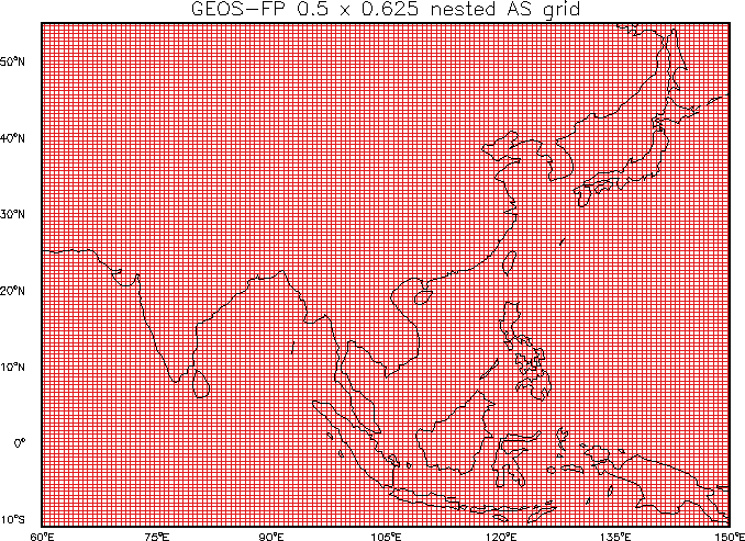
0.5 x 0.625 AS nested grid
This is the MERRA-2 native resolution nested grid over China and SE Asia.
This grid may be specified with the following settings in input.geos (in GEOS-Chem 12.4.0 and later).
0.5° x 0.625° AS longitude centers:
  60.000   60.625   61.250   61.875   62.500   63.125   63.750   64.375
  65.000   65.625   66.250   66.875   67.500   68.125   68.750   69.375
  70.000   70.625   71.250   71.875   72.500   73.125   73.750   74.375
  75.000   75.625   76.250   76.875   77.500   78.125   78.750   79.375
  80.000   80.625   81.250   81.875   82.500   83.125   83.750   84.375
  85.000   85.625   86.250   86.875   87.500   88.125   88.750   89.375
  90.000   90.625   91.250   91.875   92.500   93.125   93.750   94.375
  95.000   95.625   96.250   96.875   97.500   98.125   98.750   99.375
 100.000  100.625  101.250  101.875  102.500  103.125  103.750  104.375
 105.000  105.625  106.250  106.875  107.500  108.125  108.750  109.375
 110.000  110.625  111.250  111.875  112.500  113.125  113.750  114.375
 115.000  115.625  116.250  116.875  117.500  118.125  118.750  119.375
 120.000  120.625  121.250  121.875  122.500  123.125  123.750  124.375
 125.000  125.625  126.250  126.875  127.500  128.125  128.750  129.375
 130.000  130.625  131.250  131.875  132.500  133.125  133.750  134.375
 135.000  135.625  136.250  136.875  137.500  138.125  138.750  139.375
 140.000  140.625  141.250  141.875  142.500  143.125  143.750  144.375
 145.000  145.625  146.250  146.875  147.500  148.125  148.750  149.375
 150.000
0.5° x 0.625° AS latitude centers:
 -11.000  -10.500  -10.000   -9.500   -9.000   -8.500   -8.000   -7.500
  -7.000   -6.500   -6.000   -5.500   -5.000   -4.500   -4.000   -3.500
  -3.000   -2.500   -2.000   -1.500   -1.000   -0.500    0.000    0.500
   1.000    1.500    2.000    2.500    3.000    3.500    4.000    4.500
   5.000    5.500    6.000    6.500    7.000    7.500    8.000    8.500
   9.000    9.500   10.000   10.500   11.000   11.500   12.000   12.500
  13.000   13.500   14.000   14.500   15.000   15.500   16.000   16.500
  17.000   17.500   18.000   18.500   19.000   19.500   20.000   20.500
  21.000   21.500   22.000   22.500   23.000   23.500   24.000   24.500
  25.000   25.500   26.000   26.500   27.000   27.500   28.000   28.500
  29.000   29.500   30.000   30.500   31.000   31.500   32.000   32.500
  33.000   33.500   34.000   34.500   35.000   35.500   36.000   36.500
  37.000   37.500   38.000   38.500   39.000   39.500   40.000   40.500
  41.000   41.500   42.000   42.500   43.000   43.500   44.000   44.500
  45.000   45.500   46.000   46.500   47.000   47.500   48.000   48.500
  49.000   49.500   50.000   50.500   51.000   51.500   52.000   52.500
  53.000   53.500   54.000   54.500   55.000
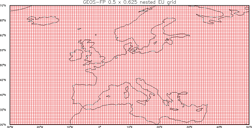
0.5 x 0.625 EU nested grid
This is the MERRA-2 native resolution nested grid over Europe.
This grid may be specified via FlexGrid with these settings in input.geos (in GEOS-Chem 12.4.0 and later).
0.5° x 0.625° EU longitude centers:
 -30.000  -29.375  -28.750  -28.125  -27.500  -26.875  -26.250  -25.625
 -25.000  -24.375  -23.750  -23.125  -22.500  -21.875  -21.250  -20.625
 -20.000  -19.375  -18.750  -18.125  -17.500  -16.875  -16.250  -15.625
 -15.000  -14.375  -13.750  -13.125  -12.500  -11.875  -11.250  -10.625
 -10.000   -9.375   -8.750   -8.125   -7.500   -6.875   -6.250   -5.625
  -5.000   -4.375   -3.750   -3.125   -2.500   -1.875   -1.250   -0.625
   0.000    0.625    1.250    1.875    2.500    3.125    3.750    4.375
   5.000    5.625    6.250    6.875    7.500    8.125    8.750    9.375
  10.000   10.625   11.250   11.875   12.500   13.125   13.750   14.375
  15.000   15.625   16.250   16.875   17.500   18.125   18.750   19.375
  20.000   20.625   21.250   21.875   22.500   23.125   23.750   24.375
  25.000   25.625   26.250   26.875   27.500   28.125   28.750   29.375
  30.000   30.625   31.250   31.875   32.500   33.125   33.750   34.375
  35.000   35.625   36.250   36.875   37.500   38.125   38.750   39.375
  40.000   40.625   41.250   41.875   42.500   43.125   43.750   44.375
  45.000   45.625   46.250   46.875   47.500   48.125   48.750   49.375
  50.000
0.5° x 0.625° EU latitude centers:
  30.000   30.500   31.000   31.500   32.000   32.500   33.000   33.500
  34.000   34.500   35.000   35.500   36.000   36.500   37.000   37.500
  38.000   38.500   39.000   39.500   40.000   40.500   41.000   41.500
  42.000   42.500   43.000   43.500   44.000   44.500   45.000   45.500
  46.000   46.500   47.000   47.500   48.000   48.500   49.000   49.500
  50.000   50.500   51.000   51.500   52.000   52.500   53.000   53.500
  54.000   54.500   55.000   55.500   56.000   56.500   57.000   57.500
  58.000   58.500   59.000   59.500   60.000   60.500   61.000   61.500
  62.000   62.500   63.000   63.500   64.000   64.500   65.000   65.500
  66.000   66.500   67.000   67.500   68.000   68.500   69.000   69.500
  70.000
0.5 x 0.625 NA nested grid
This is the MERRA-2 native resolution nested grid over North America.
This grid may be specified via FlexGrid with these settings in input.geos (in GEOS-Chem 12.4.0 and later).
0.5° x 0.625° NA longitude centers:
-140.000 -139.375 -138.750 -138.125 -137.500 -136.875 -136.250 -135.625
-135.000 -134.375 -133.750 -133.125 -132.500 -131.875 -131.250 -130.625
-130.000 -129.375 -128.750 -128.125 -127.500 -126.875 -126.250 -125.625
-125.000 -124.375 -123.750 -123.125 -122.500 -121.875 -121.250 -120.625
-120.000 -119.375 -118.750 -118.125 -117.500 -116.875 -116.250 -115.625
-115.000 -114.375 -113.750 -113.125 -112.500 -111.875 -111.250 -110.625
-110.000 -109.375 -108.750 -108.125 -107.500 -106.875 -106.250 -105.625
-105.000 -104.375 -103.750 -103.125 -102.500 -101.875 -101.250 -100.625
-100.000  -99.375  -98.750  -98.125  -97.500  -96.875  -96.250  -95.625
 -95.000  -94.375  -93.750  -93.125  -92.500  -91.875  -91.250  -90.625
 -90.000  -89.375  -88.750  -88.125  -87.500  -86.875  -86.250  -85.625
 -85.000  -84.375  -83.750  -83.125  -82.500  -81.875  -81.250  -80.625
 -80.000  -79.375  -78.750  -78.125  -77.500  -76.875  -76.250  -75.625
 -75.000  -74.375  -73.750  -73.125  -72.500  -71.875  -71.250  -70.625
 -70.000  -69.375  -68.750  -68.125  -67.500  -66.875  -66.250  -65.625
 -65.000  -64.375  -63.750  -63.125  -62.500  -61.875  -61.250  -60.625
 -60.000  -59.375  -58.750  -58.125  -57.500  -56.875  -56.250  -55.625
 -55.000  -54.375  -53.750  -53.125  -52.500  -51.875  -51.250  -50.625
 -50.000  -49.375  -48.750  -48.125  -47.500  -46.875  -46.250  -45.625
 -45.000  -44.375  -43.750  -43.125  -42.500  -41.875  -41.250  -40.625
 -40.000
0.5° x 0.625° NA latitude centers:
  10.000   10.500   11.000   11.500   12.000   12.500   13.000   13.500
  14.000   14.500   15.000   15.500   16.000   16.500   17.000   17.500
  18.000   18.500   19.000   19.500   20.000   20.500   21.000   21.500
  22.000   22.500   23.000   23.500   24.000   24.500   25.000   25.500
  26.000   26.500   27.000   27.500   28.000   28.500   29.000   29.500
  30.000   30.500   31.000   31.500   32.000   32.500   33.000   33.500
  34.000   34.500   35.000   35.500   36.000   36.500   37.000   37.500
  38.000   38.500   39.000   39.500   40.000   40.500   41.000   41.500
  42.000   42.500   43.000   43.500   44.000   44.500   45.000   45.500
  46.000   46.500   47.000   47.500   48.000   48.500   49.000   49.500
  50.000   50.500   51.000   51.500   52.000   52.500   53.000   53.500
  54.000   54.500   55.000   55.500   56.000   56.500   57.000   57.500
  58.000   58.500   59.000   59.500   60.000   60.500   61.000   61.500
  62.000   62.500   63.000   63.500   64.000   64.500   65.000   65.500
  66.000   66.500   67.000   67.500   68.000   68.500   69.000   69.500
  70.000
GMAO 0.25 x 0.3125 grid
This is the native resolution of the GEOS-5 "forward processing" (which we call GEOS-FP) operational data product from GMAO.
The grid coordinates are computed as follows:
Lon_Center(I) = -180° + [ 0.3125° * ( I - 1 ) ],  I = 1, 1152
Lat_Center(I) =  -90° + [ 0.25°   * ( J - 1 ) ],  J = 1, 721
0.25 x 0.3125 CH nested grid
This is the GEOS-FP native-resolution nested-grid over China.
This grid may be specified via FlexGrid with these settings in input.geos (in GEOS-Chem 12.4.0 and later).
0.25° x 0.3125° CH longitude centers:
  70.0000   70.3125   70.6250   70.9375   71.2500   71.5625   71.8750   72.1875
  72.5000   72.8125   73.1250   73.4375   73.7500   74.0625   74.3750   74.6875
  75.0000   75.3125   75.6250   75.9375   76.2500   76.5625   76.8750   77.1875
  77.5000   77.8125   78.1250   78.4375   78.7500   79.0625   79.3750   79.6875
  80.0000   80.3125   80.6250   80.9375   81.2500   81.5625   81.8750   82.1875
  82.5000   82.8125   83.1250   83.4375   83.7500   84.0625   84.3750   84.6875
  85.0000   85.3125   85.6250   85.9375   86.2500   86.5625   86.8750   87.1875
  87.5000   87.8125   88.1250   88.4375   88.7500   89.0625   89.3750   89.6875
  90.0000   90.3125   90.6250   90.9375   91.2500   91.5625   91.8750   92.1875
  92.5000   92.8125   93.1250   93.4375   93.7500   94.0625   94.3750   94.6875
  95.0000   95.3125   95.6250   95.9375   96.2500   96.5625   96.8750   97.1875
  97.5000   97.8125   98.1250   98.4375   98.7500   99.0625   99.3750   99.6875
 100.0000  100.3125  100.6250  100.9375  101.2500  101.5625  101.8750  102.1875
 102.5000  102.8125  103.1250  103.4375  103.7500  104.0625  104.3750  104.6875
 105.0000  105.3125  105.6250  105.9375  106.2500  106.5625  106.8750  107.1875
 107.5000  107.8125  108.1250  108.4375  108.7500  109.0625  109.3750  109.6875
 110.0000  110.3125  110.6250  110.9375  111.2500  111.5625  111.8750  112.1875
 112.5000  112.8125  113.1250  113.4375  113.7500  114.0625  114.3750  114.6875
 115.0000  115.3125  115.6250  115.9375  116.2500  116.5625  116.8750  117.1875
 117.5000  117.8125  118.1250  118.4375  118.7500  119.0625  119.3750  119.6875
 120.0000  120.3125  120.6250  120.9375  121.2500  121.5625  121.8750  122.1875
 122.5000  122.8125  123.1250  123.4375  123.7500  124.0625  124.3750  124.6875
 125.0000  125.3125  125.6250  125.9375  126.2500  126.5625  126.8750  127.1875
 127.5000  127.8125  128.1250  128.4375  128.7500  129.0625  129.3750  129.6875
 130.0000  130.3125  130.6250  130.9375  131.2500  131.5625  131.8750  132.1875
 132.5000  132.8125  133.1250  133.4375  133.7500  134.0625  134.3750  134.6875
 135.0000  135.3125  135.6250  135.9375  136.2500  136.5625  136.8750  137.1875
 137.5000  137.8125  138.1250  138.4375  138.7500  139.0625  139.3750  139.6875
 140.0000
0.25° x 0.3125° CH latitude centers:
  15.0000   15.2500   15.5000   15.7500   16.0000   16.2500   16.5000   16.7500
  17.0000   17.2500   17.5000   17.7500   18.0000   18.2500   18.5000   18.7500
  19.0000   19.2500   19.5000   19.7500   20.0000   20.2500   20.5000   20.7500
  21.0000   21.2500   21.5000   21.7500   22.0000   22.2500   22.5000   22.7500
  23.0000   23.2500   23.5000   23.7500   24.0000   24.2500   24.5000   24.7500
  25.0000   25.2500   25.5000   25.7500   26.0000   26.2500   26.5000   26.7500
  27.0000   27.2500   27.5000   27.7500   28.0000   28.2500   28.5000   28.7500
  29.0000   29.2500   29.5000   29.7500   30.0000   30.2500   30.5000   30.7500
  31.0000   31.2500   31.5000   31.7500   32.0000   32.2500   32.5000   32.7500
  33.0000   33.2500   33.5000   33.7500   34.0000   34.2500   34.5000   34.7500
  35.0000   35.2500   35.5000   35.7500   36.0000   36.2500   36.5000   36.7500
  37.0000   37.2500   37.5000   37.7500   38.0000   38.2500   38.5000   38.7500
  39.0000   39.2500   39.5000   39.7500   40.0000   40.2500   40.5000   40.7500
  41.0000   41.2500   41.5000   41.7500   42.0000   42.2500   42.5000   42.7500
  43.0000   43.2500   43.5000   43.7500   44.0000   44.2500   44.5000   44.7500
  45.0000   45.2500   45.5000   45.7500   46.0000   46.2500   46.5000   46.7500
  47.0000   47.2500   47.5000   47.7500   48.0000   48.2500   48.5000   48.7500
  49.0000   49.2500   49.5000   49.7500   50.0000   50.2500   50.5000   50.7500
  51.0000   51.2500   51.5000   51.7500   52.0000   52.2500   52.5000   52.7500
  53.0000   53.2500   53.5000   53.7500   54.0000   54.2500   54.5000   54.7500
  55.0000
0.25 x 0.3125 EU nested grid
This is the GEOS-FP native-resolution nested-grid over Europe.
This grid may be specified via FlexGrid with these settings in input.geos (in GEOS-Chem 12.4.0 and later).
0.25° x 0.3125° EU longitude centers:
  -15.0000 -14.6875 -14.3750 -14.0625 -13.7500 -13.4375 -13.1250 -12.8125
  -12.5000 -12.1875 -11.8750 -11.5625 -11.2500 -10.9375 -10.6250 -10.3125
  -10.0000  -9.6875  -9.3750  -9.0625  -8.7500  -8.4375  -8.1250  -7.8125
   -7.5000  -7.1875  -6.8750  -6.5625  -6.2500  -5.9375  -5.6250  -5.3125
   -5.0000  -4.6875  -4.3750  -4.0625  -3.7500  -3.4375  -3.1250  -2.8125
   -2.5000  -2.1875  -1.8750  -1.5625  -1.2500  -0.9375  -0.6250  -0.3125
    0.0000   0.3125   0.6250   0.9375   1.2500   1.5625   1.8750   2.1875
    2.5000   2.8125   3.1250   3.4375   3.7500   4.0625   4.3750   4.6875
    5.0000   5.3125   5.6250   5.9375   6.2500   6.5625   6.8750   7.1875
    7.5000   7.8125   8.1250   8.4375   8.7500   9.0625   9.3750   9.6875
   10.0000  10.3125  10.6250  10.9375  11.2500  11.5625  11.8750  12.1875
   12.5000  12.8125  13.1250  13.4375  13.7500  14.0625  14.3750  14.6875
   15.0000  15.3125  15.6250  15.9375  16.2500  16.5625  16.8750  17.1875
   17.5000  17.8125  18.1250  18.4375  18.7500  19.0625  19.3750  19.6875
   20.0000  20.3125  20.6250  20.9375  21.2500  21.5625  21.8750  22.1875
   22.5000  22.8125  23.1250  23.4375  23.7500  24.0625  24.3750  24.6875
   25.0000  25.3125  25.6250  25.9375  26.2500  26.5625  26.8750  27.1875
   27.5000  27.8125  28.1250  28.4375  28.7500  29.0625  29.3750  29.6875
   30.0000  30.3125  30.6250  30.9375  31.2500  31.5625  31.8750  32.1875
   32.5000  32.8125  33.1250  33.4375  33.7500  34.0625  34.3750  34.6875
   35.0000  35.3125  35.6250  35.9375  36.2500  36.5625  36.8750  37.1875
   37.5000  37.8125  38.1250  38.4375  38.7500  39.0625  39.3750  39.6875
   40.0000
0.25° x 0.3125° EU latitude centers:
  32.7500   33.0000   33.2500   33.5000   33.7500   34.0000   34.2500   34.5000
  34.7500   35.0000   35.2500   35.5000   35.7500   36.0000   36.2500   36.5000
  36.7500   37.0000   37.2500   37.5000   37.7500   38.0000   38.2500   38.5000
  38.7500   39.0000   39.2500   39.5000   39.7500   40.0000   40.2500   40.5000
  40.7500   41.0000   41.2500   41.5000   41.7500   42.0000   42.2500   42.5000
  42.7500   43.0000   43.2500   43.5000   43.7500   44.0000   44.2500   44.5000
  44.7500   45.0000   45.2500   45.5000   45.7500   46.0000   46.2500   46.5000
  46.7500   47.0000   47.2500   47.5000   47.7500   48.0000   48.2500   48.5000
  48.7500   49.0000   49.2500   49.5000   49.7500   50.0000   50.2500   50.5000
  50.7500   51.0000   51.2500   51.5000   51.7500   52.0000   52.2500   52.5000
  52.7500   53.0000   53.2500   53.5000   53.7500   54.0000   54.2500   54.5000
  54.7500   55.0000   55.2500   55.5000   55.7500   56.0000   56.2500   56.5000
  56.7500   57.0000   57.2500   57.5000   57.7500   58.0000   58.2500   58.5000
  58.7500   59.0000   59.2500   59.5000   59.7500   60.0000   60.2500   60.5000
  60.7500   61.0000   61.2500
0.25 x 0.3125 NA nested grid
This is the GEOS-FP native-resolution nested-grid over North America
This grid may be specified via FlexGrid with these settings in input.geos (in GEOS-Chem 12.4.0 and later).
0.25° x 0.3125° NA longitude centers:
-130.0000 -129.6875 -129.3750 -129.0625 -128.7500 -128.4375 -128.1250 -127.8125
-127.5000 -127.1875 -126.8750 -126.5625 -126.2500 -125.9375 -125.6250 -125.3125
-125.0000 -124.6875 -124.3750 -124.0625 -123.7500 -123.4375 -123.1250 -122.8125
-122.5000 -122.1875 -121.8750 -121.5625 -121.2500 -120.9375 -120.6250 -120.3125
-120.0000 -119.6875 -119.3750 -119.0625 -118.7500 -118.4375 -118.1250 -117.8125
-117.5000 -117.1875 -116.8750 -116.5625 -116.2500 -115.9375 -115.6250 -115.3125
-115.0000 -114.6875 -114.3750 -114.0625 -113.7500 -113.4375 -113.1250 -112.8125
-112.5000 -112.1875 -111.8750 -111.5625 -111.2500 -110.9375 -110.6250 -110.3125
-110.0000 -109.6875 -109.3750 -109.0625 -108.7500 -108.4375 -108.1250 -107.8125
-107.5000 -107.1875 -106.8750 -106.5625 -106.2500 -105.9375 -105.6250 -105.3125
-105.0000 -104.6875 -104.3750 -104.0625 -103.7500 -103.4375 -103.1250 -102.8125
-102.5000 -102.1875 -101.8750 -101.5625 -101.2500 -100.9375 -100.6250 -100.3125
-100.0000  -99.6875  -99.3750  -99.0625  -98.7500  -98.4375  -98.1250  -97.8125
 -97.5000  -97.1875  -96.8750  -96.5625  -96.2500  -95.9375  -95.6250  -95.3125
 -95.0000  -94.6875  -94.3750  -94.0625  -93.7500  -93.4375  -93.1250  -92.8125
 -92.5000  -92.1875  -91.8750  -91.5625  -91.2500  -90.9375  -90.6250  -90.3125
 -90.0000  -89.6875  -89.3750  -89.0625  -88.7500  -88.4375  -88.1250  -87.8125
 -87.5000  -87.1875  -86.8750  -86.5625  -86.2500  -85.9375  -85.6250  -85.3125
 -85.0000  -84.6875  -84.3750  -84.0625  -83.7500  -83.4375  -83.1250  -82.8125
 -82.5000  -82.1875  -81.8750  -81.5625  -81.2500  -80.9375  -80.6250  -80.3125
 -80.0000  -79.6875  -79.3750  -79.0625  -78.7500  -78.4375  -78.1250  -77.8125
 -77.5000  -77.1875  -76.8750  -76.5625  -76.2500  -75.9375  -75.6250  -75.3125
 -75.0000  -74.6875  -74.3750  -74.0625  -73.7500  -73.4375  -73.1250  -72.8125
 -72.5000  -72.1875  -71.8750  -71.5625  -71.2500  -70.9375  -70.6250  -70.3125
 -70.0000  -69.6875  -69.3750  -69.0625  -68.7500  -68.4375  -68.1250  -67.8125
 -67.5000  -67.1875  -66.8750  -66.5625  -66.2500  -65.9375  -65.6250  -65.3125
 -65.0000  -64.6875  -64.3750  -64.0625  -63.7500  -63.4375  -63.1250  -62.8125
 -62.5000  -62.1875  -61.8750  -61.5625  -61.2500  -60.9375  -60.6250  -60.3125
 -60.0000
0.25° x 0.3125° NA latitude centers:
   9.7500   10.0000   10.2500   10.5000   10.7500   11.0000   11.2500   11.5000
  11.7500   12.0000   12.2500   12.5000   12.7500   13.0000   13.2500   13.5000
  13.7500   14.0000   14.2500   14.5000   14.7500   15.0000   15.2500   15.5000
  15.7500   16.0000   16.2500   16.5000   16.7500   17.0000   17.2500   17.5000
  17.7500   18.0000   18.2500   18.5000   18.7500   19.0000   19.2500   19.5000
  19.7500   20.0000   20.2500   20.5000   20.7500   21.0000   21.2500   21.5000
  21.7500   22.0000   22.2500   22.5000   22.7500   23.0000   23.2500   23.5000
  23.7500   24.0000   24.2500   24.5000   24.7500   25.0000   25.2500   25.5000
  25.7500   26.0000   26.2500   26.5000   26.7500   27.0000   27.2500   27.5000
  27.7500   28.0000   28.2500   28.5000   28.7500   29.0000   29.2500   29.5000
  29.7500   30.0000   30.2500   30.5000   30.7500   31.0000   31.2500   31.5000
  31.7500   32.0000   32.2500   32.5000   32.7500   33.0000   33.2500   33.5000
  33.7500   34.0000   34.2500   34.5000   34.7500   35.0000   35.2500   35.5000
  35.7500   36.0000   36.2500   36.5000   36.7500   37.0000   37.2500   37.5000
  37.7500   38.0000   38.2500   38.5000   38.7500   39.0000   39.2500   39.5000
  39.7500   40.0000   40.2500   40.5000   40.7500   41.0000   41.2500   41.5000
  41.7500   42.0000   42.2500   42.5000   42.7500   43.0000   43.2500   43.5000
  43.7500   44.0000   44.2500   44.5000   44.7500   45.0000   45.2500   45.5000
  45.7500   46.0000   46.2500   46.5000   46.7500   47.0000   47.2500   47.5000
  47.7500   48.0000   48.2500   48.5000   48.7500   49.0000   49.2500   49.5000
  49.7500   50.0000   50.2500   50.5000   50.7500   51.0000   51.2500   51.5000
  51.7500   52.0000   52.2500   52.5000   52.7500   53.0000   53.2500   53.5000
  53.7500   54.0000   54.2500   54.5000   54.7500   55.0000   55.2500   55.5000
  55.7500   56.0000   56.2500   56.5000   56.7500   57.0000   57.2500   57.5000
  57.7500   58.0000   58.2500   58.5000   58.7500   59.0000   59.2500   59.5000
  59.7500   60.0000
Cubed-sphere grids used by GCHP
GEOS-Chem with the high-perfomance option (aka GCHP) uses cubed-sphere horizontal grids instead of the traditional cartesian grids. For a good general description of cubed sphere grids, please follow this link.
Cubed-sphere grid resolutions are denoted using the number of grid points on each face. The table below shows some common cubed-sphere configurations used by GCHP. At present GCHP uses grids with 72 vertical layers, but this may increase to 132 layers in the near future.
| Grid | # points per face |
# of cells at surface |
# of layers | # of cells (total) |
Equiv. lat-lon grid |
|---|---|---|---|---|---|
| C24 | 24 | 3456 | 72 | 248,832 | 4° x 5° |
| C48 | 48 | 13,824 | 72 | 995,328 | 2° x 2.5° |
| C90 | 90 | 48,600 | 72 | 3,499,200 | 1° x 1.25° |
| C180 | 180 | 194,400 | 72 | 13,996,800 | 0.5° x 0.625° |
| C360 | 360 | 777,600 | 72 | 55,987,200 | 0.25° x 0.3125° |
Reference: Eastham, S.D., M.S. Long, C.A. Keller, E. Lundgren, R.M. Yantosca, J. Zhuang, C. Li, C.J. Lee, M. Yannetti, B.M. Auer, T.L. Clune, J. Kouatchou, W.M. Putman, M.A. Thompson, A.L. Trayanov, A.M. Molod, R.V. Martin, and D.J. Jacob, GEOS-Chem High Performance (GCHP): A next-generation implementation of the GEOS-Chem chemical transport model for massively parallel applications, Geosci. Mod. Dev., 11, 2941-2953, 2018. PDF
